Master of Permanent Training in Geographic Information Systems + 60 ECTS credits


Request information


Syllabus
Download syllabus in PDFCurriculum
Summary
The Master in Geographic Information Systems covers subjects such as geomatic, remote sensing, Introduction to the SIG, GVSIG, QGIS, ArcGIS 10, GIS web applications with QGIS and OpenGeo Suite, and ArcGIS API. It provides comprehensive training in geospatial data management and analysis, covering from capture to the visualization and creation of interactive maps. Students acquire practical skills to use leading tools and platforms in the industry, as well as to develop web applications and perform advanced spatial analyzes. The program prepares students to face the current and future challenges in the SIG field and provides a solid theoretical and practical training.
Goals
Professional opportunities
To prepare you
The Master in Geographic Information Systems prepares you to acquire technical skills in the management and analysis of geospatial data, using avant -garde tools and technologies. It enables you to apply knowledge in fields such as cartography, urban planning, environmental management and geoinformatics, and provides opportunities to advance your professional career in an environment promoted by geographical information. This GIS Web Application Course with QGIS and OpenGeo Suite prepares you to specialize in GIS web applications with QGIS and OpenGeo Suite within the Profession Internet application, through knowledge of OPE programs
Who is it addressed to?
The Master in Geographic Information Systems is aimed at professionals and graduates interested in acquiring specialized knowledge in geospatial data management and analysis. It provides a solid basis to face current and future challenges in the field of geographical information systems.
Official Character
This training is not included in the scope of official regulated training (Infant Education, Primary Education, Secondary Education, Official Professional Training FP, Baccalaureate, University Degree, Official University Master and PhD). It is therefore a complementary and/or specialization training, aimed at acquiring certain skills, skills or aptitudes of a professional nature, being able to be barely as merit in workbags and/or opposition competitions, always within the complementary training section and/or continuous training being always essential to review the specific requirements of the public labor stock of the public labor stock market.

Our methodology combines technology, pedagogy and empathy for learning tailored to you.
You set the pace, decide the path and artificial intelligence accompanies you so that you learn better, with meaning and purpose.

Truly personalized learning
Your style, interests and level define the route. You are the starting point.

Constructivism in action
Explore, experiment and apply. Learning means understanding, not memorizing.

AI that accompanies you, not directs you
PHIA, our artificial intelligence assistant guides you without limiting your autonomy.

Evaluation without pressure
Continuous and adaptive feedback. Because learning is a process, not a number.
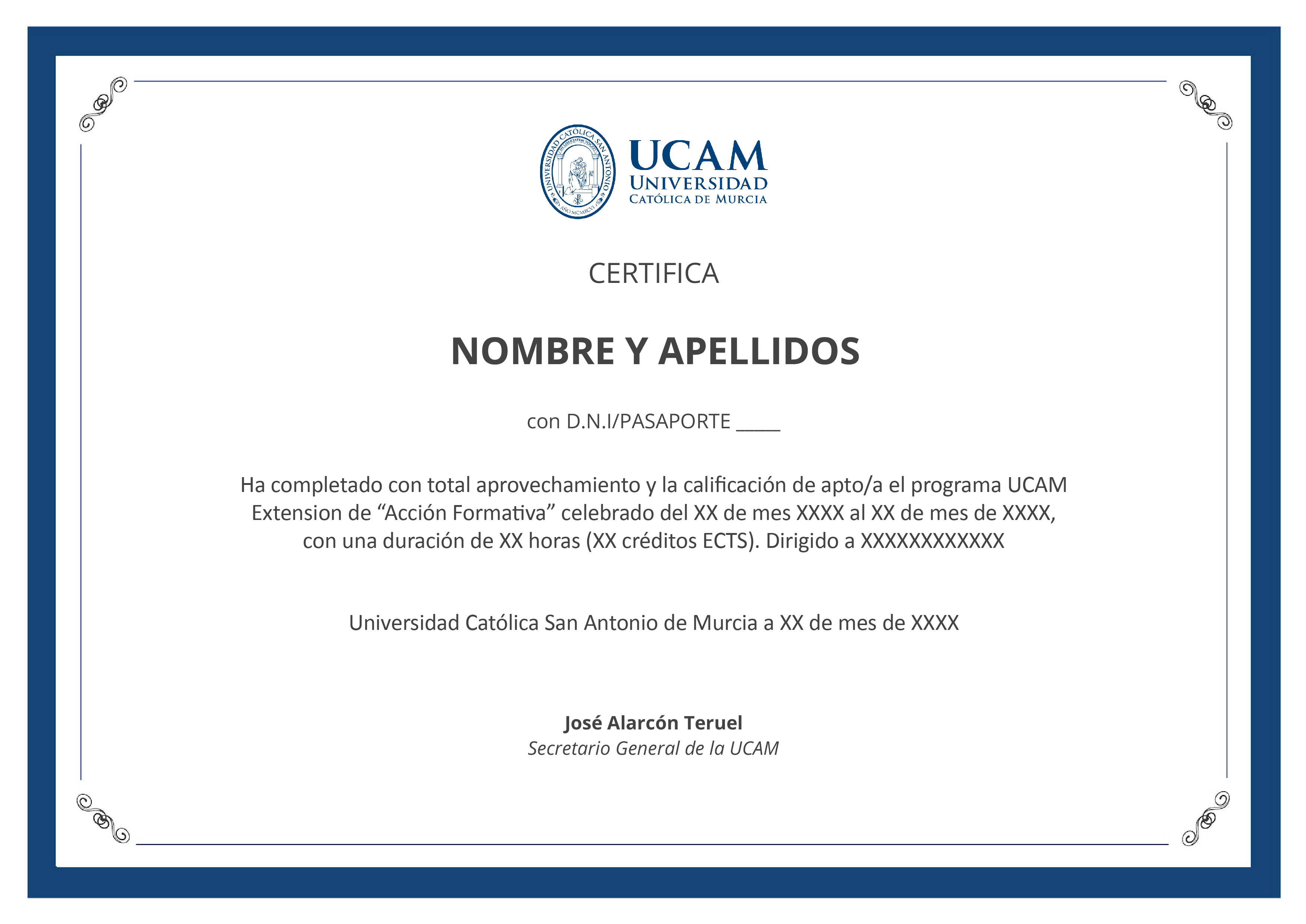
Certification
University degree of Master in Permanent Training in Geographic Information Systems with 1500 hours and 60 ECTS credits from the Catholic University of Murcia
EducaHub Scholarships
Make your training more accessible: finance at 0% interest and obtain personalized scholarships.
At EducaHub we believe that education should be available to everyone. For this reason, we offer a Scholarship Plan that facilitates your access to practical, current and quality training, eliminating economic barriers.
-25%
Alumni Scholarship: for former EducaHub students.
-20%
Unemployment Scholarship: if you prove that you are unemployed.
-20%
Large Family Scholarship: for families with 3 or more children.
-20%
Disability Scholarship: for people with disabilities ≥33%.
-15%
Emprende Scholarship: for self-employed workers who can prove their activity.
-15%
Recommended Scholarship: if you come recommended by a former student.
-15%
Group Scholarship: for joint registrations of 3 or more people.
An entire educational universe, on a single platform.
An intuitive environment with AI that guides you to train autonomously and with purpose.

Learn at your pace
Courses, master's degrees and official qualifications. 100% online, flexible and at your pace.

Access from anywhere
Available 24/7 on mobile, tablet or PC. You decide when and how to train.

Phia, your AI mentor
It challenges you, motivates you and personalizes your path. Learn with a guide that evolves with you.

LX One Plus: Training without limits
Unlock soft skills, languages and more. Move towards comprehensive and continuous training.